


Learning the Land: A Frozen Force
Have you ever wondered why the Fox Valley area is so flat, or why Lake Winnebago exists, or why the region has a large paper industry? Well, imagine masses of ice towering far above the tallest buildings and trees, slowly crawling across the land, scouring the earth beneath and leaving behind silt and clay in their wake. These are called glaciers, and they once covered much of Wisconsin, playing a major role in forming its landscape and history.
Beginning more than two million years ago, a series of ice ages consumed the planet. Four distinct times the globe cooled, the seas shrunk, and ice from the Arctic and Antarctic extended into the traditionally warmer climates for up to hundreds of thousands of years at a time. These massive glaciers were dynamic beasts, advancing and receding across the land, carrying and depositing material wherever they went. Their size, along with the scope of their coverage, gave them much influence over the land they traveled.
Source: K.A. Lemke https://www4.uwsp.edu/geo/faculty/lemke/geol370/lectures/05_meltwater_lakes.html
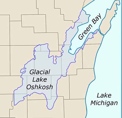
While glaciers have an abundance of telltale geological markers, from flattening landscapes to unique rock formations, perhaps the most noticeable effect we can see today is their lake-making habits. The Great Lakes, for example, are largely a result of the glaciers that moved back and forth, carving the basins and filling them. Closer to home, our own Lake Winnebago is the remnant of the much larger Glacial Lake Oshkosh.
Glaciers primarily form lakes by cutting off existing drainage systems. When Glacial Lake Oshkosh formed, a mass of ice sat to the north-east, preventing water from draining into Lake Michigan. Like a beaver dam on a creek, just on an incredibly larger scale, the inability for the water to flow through resulted in it piling up into a massive lake. At its maximum, Glacial Lake Oshkosh extended from Portage, where it could drain into the Wisconsin River system, to north of Green Bay, and covered what is today the Fox Valley.
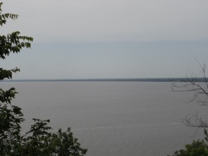
Lake Winnebago with the Fox Cities in the distance. Everything here was once beneath the surface of Glacial Lake Oshkosh
To get a sense of the impact the lake had on the region, think about what the bottom of a lake is like. Sandy, muddy, and full of clay, this glacial lake bed became the surface we live on today. The Fox Valley area is characteristic for its heavy clay soils, soils that are difficult to grow things in. This could be thought of as detrimental, preventing a large agricultural presence in the area, but has instead allowed the Fox Cities to focus on industrial practices, like the paper manufacturing the region is so famed for. The industrialization of the area was hugely influenced by the Fox River, which cut through the leftover glacial sediments. We’ll look at the river in depth in a later post.
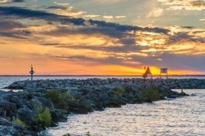
While it’s been thousands to millions of years since glaciers roamed the Wisconsin terrain, their effects on the region were vast, shaping the land, both geologically and historically, to what it is today. Next time you take a dip in Lake Winnebago or walk along the Fox, spare a moment to thank our late icy friends.
Information from: Roadside Geology of Wisconsin by Robert H. Dott, Jr. and John W. Attig; https://gsa.confex.com/gsa/2005NC/finalprogram/abstract_86950.htm.


Leave a Comment